Next up on my self
directed tour of Sri Lanka was the city of Kandy. It is on nearly
every suggested itinerary of the country, which is how it ended up on
my itinerary.
Kandy was the last
seat of the ancient kings in Sri Lanka, and is an important religious
sight as well. In terms of what I'd already seen in Sri Lanka, Kandy
is a young city. Wikipedia tells me the first king of the Kingdom of
Kandy lived in the 15th and 16th centuries.
It seems that none
of the ancient kingdoms ruled the entire island of Sri Lanka, which
surprised me for I don't know what reason.
The island isn't big, I
guess I expected at least one of the kingdoms to take over
everything. Even when the Europeans began to colonize the island,
none of them ruled over the whole island.
Kandy was still a
kingdom when the Portuguese ruled some of the land, and the Dutch as
well.
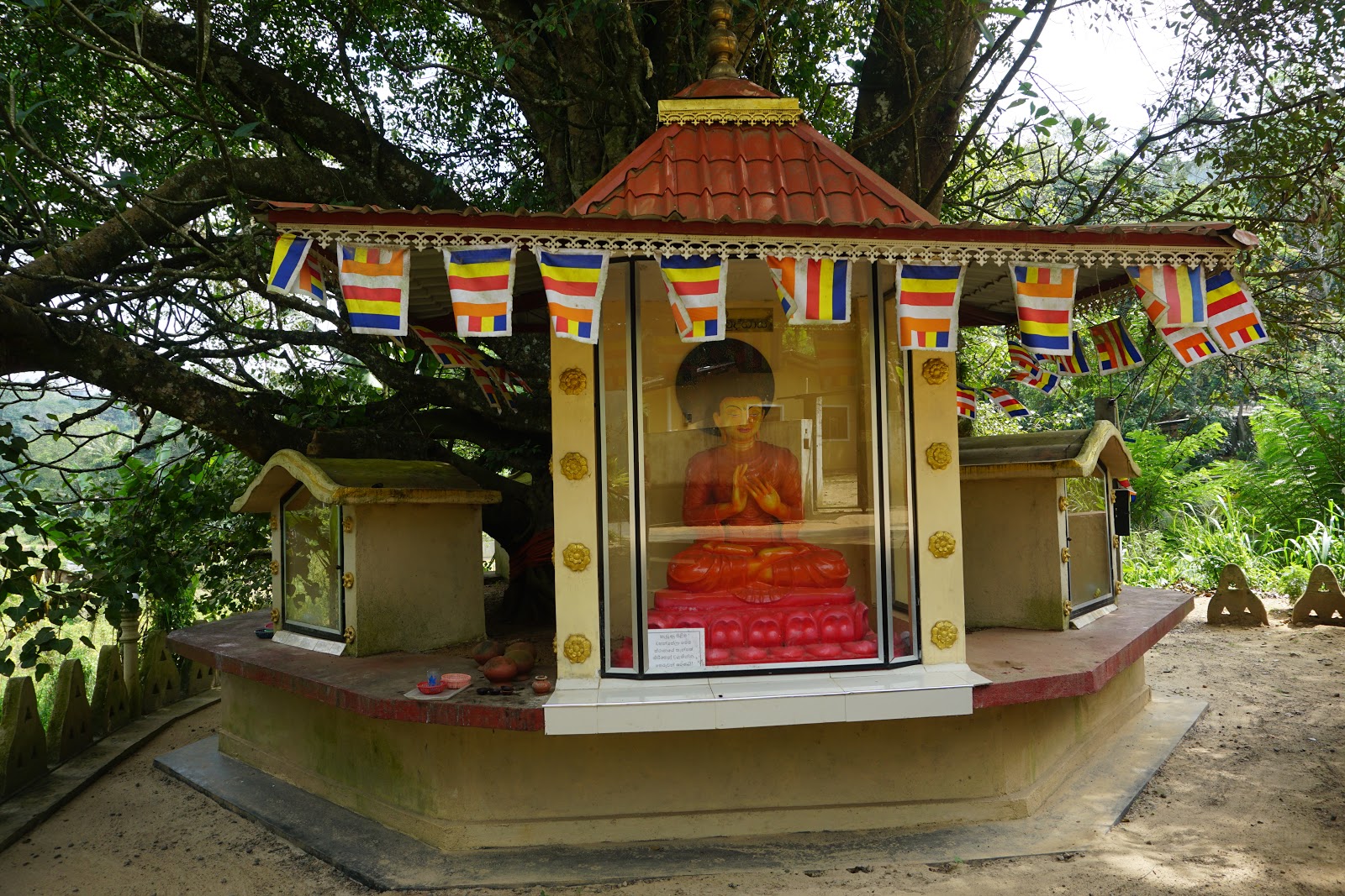
The main religious
sight in Kandy is the main reason Sri Lankans come to Kandy: the
Temple of the Tooth Relic.
Kandy is only 75
kilometers from Dambulla, my bus between the two cities took abot two
hours to make that distance. The bus station in Kandy is big and
chaotic, it took me a while to figure out how to get out.
Once I got out I
followed a tout to a place to stay, the first place was full. I don't
know if it was actually full, but that's what they said. Oh well. The
next place quoted me a price that was about double what I'd been
paying, and the room was definitely not two times better. I said I
didn't want air conditioning, as I knew a fan would be fine, which
was the key to a much cheaper room.
After relaxing for
a bit, I started walking. Kandy is a busy city. There were a lot of
cars and tuktuks and bikes and people on the streets, everything was
crazy.
I ended up stopping for food, since I hadn't yet eaten that
day. I walked into a random place that did not seem touristy, because
no one was using utensils to eat. I chose well, as the food was
simple, good, and cheap. Apparently it was also all you can eat,
because my plate was refilled twice, and almost a third time until I
spoke up and said no more. I was tempted, but it would've been too
much.
It took me a while
to get to the first thing I wanted to see, which is the temple I
mentioned above. Go figure, when I first arrived, it wasn't during
visiting hours for foreigners, so I kept walking.
Kandy Lake is
supposed to be a beautiful place to go for a walk. That definitely
wasn't my experience, but that could be for all kinds of reasons. I
don't think it had rained much recently, as there was plenty of dust,
and the lake was low.
I walked all the
way around the lake, which wasn't all that big, or that pretty. The
temple grounds sit on one side of the lake, so when I got to the
opposite side of the lake at least it was a little nice.
When I got back to
the temple gates it was finally foreigner visiting hours again. I
understand the reason for having special hours, since foreign
tourists tend to make a place feel less than holy by going everywhere
without respect for the place they're seeing.
I like to think I'm not
like this, but I'm sure I have my moments.
Like everywhere
else I'd already been in Sri Lanka, this place had a special entrance
fee for foreigners, argh. There was also a separate section for
foreigners to leave their shoes. I was fine with leaving my shoes in
the local section, but I wasn't allowed to. Much to my frustration,
there was a jar set up for donations in the foreigner section, but
not in the local section. Since I'd already paid for entrance to the
temple, and Sri Lankans didn't have to pay, I had zero desire to
donate more money.
This temple is a
major Buddhist pilgrimmage sight because it is said to hold a piece
of the Buddha's tooth that somehow survived his cremation. The room
holding the tooth was closed during my visit, so I have no idea what
it looked like.
The temple holding
the tooth is a couple floors tall and is full of people all the time.
Tourists were looking every which way, taking photos of everything.
Most Sri Lankans I saw were sitting and praying. (Praying to the
tooth maybe? Or to one of the Buddhist statues?)
It is up on the
second level where the faithful leave offerings, the tables were
overflowing with flowers and such.
Another big section
of the temple grounds had a few dagobas, with more people making the
rounds and praying. I think there was some sort of party or festival
coming up, as one area was full of people weaving decorations out of
palm fronds. Quite impressive.
I exited the temple
complex out the back gate, and followed the road. My map told me this
was the most convenient way to get to what I wanted to see next: the
cemetery of the British garrison, back when the Brits were in charge
of the area.
The cemetery was
small, and I wouldn't have found it if not for a small sign pointing
up a small hill. The graves weren't big, and there weren't a whole
lot of them, but I read quite a few just out of curiosity. People
seemed to do well if they lived to the ripe old age of 40 back then.
At that point I'd
seen everything I wanted to see in Kandy, so I decided to walk the
city center by following a grid pattern. I found good food this way,
(and ate way too much,) but nothing else of interest.
I found the
streets that most tourists walk, as they were lined with shops full
of kitchy Sri Lankan souvenirs, and cafes with menus in English.
I also found the
streets with stores selling things random things you only need when
you live somewhere. Those streets were much better for people
watching.
The next morning I
was up super early to walk back to the bus station. As the bus
station was quite big, I ended up wandering around for a while, until
someone asked me where I wanted to go.
After telling
someone I wanted to go to Nuwara Eliya, they took me to the next bus
leaving for that destination. The name is spelled Nuwara Eliya in
English, but when the driver called out that name, it didn't sound
like that to me. Thank goodness for helpful people.
The distance
between Kandy and Nuwara Eliya was also about 75 kilometers, but this
bus ride was a lot longer, as the road was anything but straight. It
wound through mountains, so there was going up and down, in addition
to winding around, so I spent a part of the ride trying to sleep so
as to prevent motion sickness.
Nuward Eliya has
nothing to do with ancient Sri Lanka. This was the beginning of a
completely different section of my holiday tour. The first few cities
were all about the ancient cultures and faiths of Sri Lanka. This
section was all about tea, and beautiful landscapes.
Nuwara Eliya
basically exists as a place to visit because there are a bunch of tea
plantations in the area. It is at 1868 meters, (6128 feet,) which is
considered altitude in terms of growing tea.
I'd booked a place
to stay, and walked to that spot on the map from the bus station.
When I got to that spot, my accomodation most definitely was NOT
there.
I walked up and down the street quite a ways, but it wasn't
there. I tried calling the phone number listed on the booking, but
that didn't work either.
A random tuk tuk
drove by and offered to help me out, I ended up in a random house.
When I was able to check internet, I found a message from the
accomodation I'd booked telling me to call to get directions. Argh.
Eventually I ended
up there, but I was more than a little annoyed that it was located
nowhere near the address they listed on the booking. (Yes, I made
that very clear in my review after leaving a couple days later. I
hate that sort of lie.)
The city of Nuwara
Eliya has exactly one sight: maybe one and a half.
The one is Victoria
Park, which is supposed to be pretty nice. I didn't think it was that
exciting. Nothing was in bloom, so it was all rather boring. I did
see quite a few local families having picnics, a few of them asked to
take my photo. Since it was only men asking to take the photos, I
said no.
The park had an
entrance fee for foreigners, but not for locals. Will this ever end?
So annoying.
The half sight is
the building of the post office, since it looks completely different
from anything else in the area.
I also walked into
a church, which was completely different from anything else I'd seen
in a while. I was happy to find postcards for sale there, I hadn't
had much success in finding those so far during the trip.
Dinner that night
was a random cafe, then I walked back to my room. My room was nice,
the location was not.
The next morning I
was up early in order to walk into town to pick up water and snacks
for the long day I had planned. I walked to Pedro Tea Estate, which
was the closest tea plantation I could find.
The walk was easy, and
quite pretty.
To see the tea
plantation you have to join a tour. The tour is during the day,
though the factory usually works at night, so you don't really get
the sense of how it all works.
Our guide spoke
rather quietly, so I'm not sure I heard everything, but oh well. She
explained the way tea is produced as we walked through different
sections of the factory, then the tour ended with a cup of tea for
everyone. Even though I would've loved to see the whole thing going,
I liked learning the basics of tea production.
I started learning
the differences between different teas, which mostly seem to be based
on when the leaves are picked, and how big they are. I learned that
teas grown at higher altitudes are usually a lighter flavour, and are
drunk without milk. Those grown at a lower altitude have a stronger
flavour and are usually drunk with some milk.
After the tour we
were able to walk through some of the rows of tea plants, and see
some of the tea pickers at work. These are almost all Tamil women,
and the amount they're paid is shockingly low.
They're paid by
weight, and they work hard all day every day. The places they work
are beautiful, but I'm guessing they don't notice the beauty anymore.
The tour guide said
the ladies pick 15kg of leaves each day. Think about that, 30lbs of
leaves. Then think of how 'heavy' a tea leaf feels in your hand, and
how fast you can pick those leaves.
I walked out of the
tea plantation and followed a trail to my other sight of the day, a
place called Lovers Waterfall. I think the story is something about a
guy jumping off the waterfall because of love. I don't remember the
specifics, but that doesn't matter.
The walk to the
waterfall was pretty, and allowed views over the area. The trail
wasn't busy, but when I got to the waterfall there were plenty of
people hanging around. That being said, I was still able to get
photos without other people in the frame, yay.
I could've figured
out how to climb to the top of the waterfall, as I could see a few
people up there, but I chose to skip that. After hanging out for a
while I headed back toward town.
I stopped for an
early dinner at a roadside cafe where I got to eat with my hands.
Good food, great price. As I walked home from dinner I realized the
skin on my arms was already starting to peel, eww gross.
The following
morning I was up early in order to trek into town and get to the bus
station in time to catch the first bus to my next city: Ella.
As far as I can
tell, Ella exists only as another town to support tourism. There is
no local culture, no religious sights. I'd booked a place to stay, it
was easy to find, and I was able to check in straightaway even though
it was only mid morning.
I ended up hanging
out in my room until at least noon, my hosts insisted I have a cup of
tea. Yum, and relaxing.
When I started
walking, I headed out one side of town and made my way to another tea
plantation. It took me a while to get there, with going up and down
hills, on dirt trails, etc... At a couple points during the walk I
really wondered if I was going the right way.
The last nearly 2
kilometers were pretty steep, I was huffing and puffing by the time I
walked into the office of Uva Halpe. I was sent straight to a tour
that had just started, they told me to pay afterward.
This tour gave the
same explanation of how tea is produced, but I got a much better
explanation of the different grades of tea. When we walked through
the gift store afterward, there was a display of what each grade
looks like after brewing. We also got to taste four different grades:
pekoe, flowery broken orange pekoe, broken orange pekoe, and
fannings.
I know I'm whinging
here, but the walk back into town also felt uphill much of the time.
Since every place
in Ella caters to tourists, I decided to eat touristy food: a
hamburger and fries. It was good, partly just because it was
different from what I'd been eating for the last week.
I was not
thrilled to find a 10% service charge on my bill, those always feel
sneaky to me, and make me dislike a place. I'm pretty sure those were at most places in town, argh.
Though this was New
Year's Eve I went to sleep at 2200. If there was any sort of
celebration in town, or in the area, I had no idea, because I slept
straight through the night.
My alarm went off
early, as my landlord had suggested a sunrise hike to Little Adam's
Peak. This sounded much better to me than staying up late on New
Year's Eve, and I was glad I made the choice.
Walking in the dark
wasn't always easy, but I had a head torch so at least I wasn't
completely blind. Little Adam's Peak isn't any great thing, but the
views at sunrise were really pretty.
What was not pretty
was the way my tripod tipped over, and my camera broke. Sigh. I
figured out that the camera wasn't able to focus again, though I have
no idea what exactly was broken.
I went back to my
guesthouse for breakfast, which was amazing after the hike. I dozed
for a while, then set out for my next sight: a bridge.
The nine arch
bridge is another 'iconic' photo in Sri Lanka, especially if you've
booked tickets on the trains that go through the area. There are all
sorts of photos of people hanging off trains, as it goes along the
curve of the bridge.
When I finally got
to the bridge, (which involved the most difficult hike I'd done so
far,) I was surprised to see a lot of people on the bridge itself.
When the train went through they were all taking selfies. I did walk
across the bridge and back, but had no desire to be on the bridge, or
near the tracks when the train came along.
I hiked back up a
hill, then went through town, and out another side. (There are
basically three exits/entries to Ella.) I followed the highway a long
way to get to my third and last sight of the day: a waterfall.
The waterfall is
about 10 meters off the road, so it's really easy to get to, and
pretty busy. There are stalls selling souvenirs and fruit set up
pretty close to the waterfall, it's quite annoying.
The waterfall was
quite pretty, and I was happy to see plenty of water, since I wasn't
aware of recent rains. There are different levels of the waterfall,
which is what makes it worth seeing. I bet it is amazing (and empty
of people,) during rainy season.
I stopped at
another random roadside cafe on the way back to my room. I had Sri
Lankan curries, it was a lot cheaper than the night before. And the
desert of yogurt, fruit and honey was awesome.
The next morning I
was up early again, this was basically the theme of my traveling
days. I caught the first bus coming through town (Ella doesn't have a
bus station, there is just a stop,) on its way south.
I'd love to come
back to Ella and the surrounding area, it's beautiful and there are
so many outdoor activities to do.

 I was able to book bus tickets with the help of the receptionist at my hostel, it was a lot cheaper to get to the city on my own than to sign up for a day tour with one of the many companies in town.